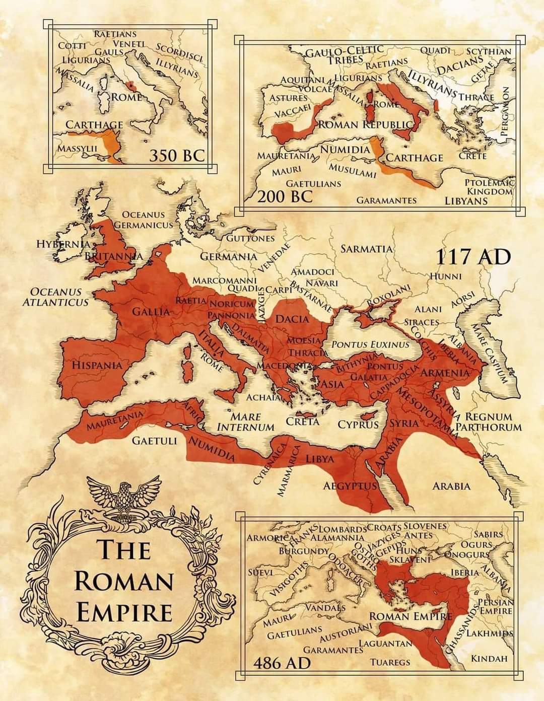
Historical map collage of the Roman Empire showing expansion from 350 BC to 486 AD on aged parchment.
An antique-style map illustrating the growth and decline of the Roman Empire across centuries, with red shaded regions marking the empire’s extent at 350 BC, 200 BC, 117 AD, and 486 AD. The parchment textures, labeled regions, and decorative cartouche convey classical cartography and historical transitions from early republic to late antique empire.

judy14 on BudgetPixel

@judy14 · 5/24/2026

Historical map collage of the Roman Empire showing expansion from 350 BC to 486 AD on aged parchment.
An antique-style map illustrating the growth and decline of the Roman Empire across centuries, with red shaded regions marking the empire’s extent at 350 BC, 200 BC, 117 AD, and 486 AD. The parchment textures, labeled regions, and decorative cartouche convey classical cartography and historical transitions from early republic to late antique empire.

Tags: Roman Empire, ancient map, historical cartography, 350 BC, 200 BC, 117 AD, 486 AD, antiqued parchment, Mediterranean empire, Roman expansion, cartography, classical atlas, ancient Rome, empire timeline, historical illustration

3 likes · 1 comments

Comments

sonny001

Very impressive!